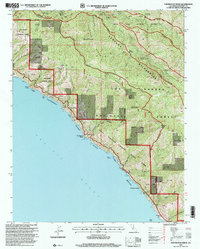
1995 Map of Partington Ridge
USGS Topo · Published 2000About this map
The Pacific Ocean coastline meets the steep slopes of the Santa Lucia Range in this late twentieth-century survey of the Big Sur region. The landscape is defined by the massive Los Padres National Forest and the interior Ventana Wilderness, where the North Fork and South Fork Big Sur River carve deep canyons through the terrain. Coastal access is marked by landmarks like Partington Point and the Sea Otter State Game Refuge, while the higher elevations are anchored by Anderson Peak and Marble Peak.
Find a feature on this map
50 named features on this map. Tap any name to fly to it.
Don’t see what you’re looking for? This feature index may not catch every label — zoom into the map to look around manually.
Map Details
Editions of this 1995 Partington Ridge Map
This is the sole edition of this map. No revisions or reprints were ever made.
Other maps of this area

1918 · Point Sur
USGS Topo · 1:62,500

1920 · Jamesburg
USGS Topo · 1:48,000

1921 · Jamesburg
USGS Topo · 1:62,500

1921 · Lucia
USGS Topo · 1:62,500

1925 · Point Sur
USGS Topo · 1:62,500

1939 · Jamesburg
USGS Topo · 1:62,500

1940 · Jamesburg
USGS Topo · 1:62,500

1941 · Lucia
USGS Topo · 1:62,500

1947 · Lucia
USGS Topo · 1:62,500

1947 · Jamesburg
USGS Topo · 1:62,500