
1940 Map of Jamesburg
USGS Topo · Published 1940About this map
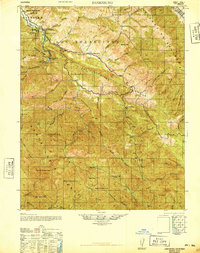
Jamesburg sits at the heart of this 1940 tactical study, marking a point of human settlement within the complex ridges of the Santa Lucia Range. The landscape is defined by the winding course of the Carmel River, which flows past landmarks like the San Clemente Dam and Rancho Del Monte. To the north, the Sierra De Salinas rises above canyon-cut terrain where local life centered around the Tularcitos School and various outposts such as Tularcitos Ranch and Camp Stephani.
Find a feature on this map
67 named features on this map. Tap any name to fly to it.
Don’t see what you’re looking for? This feature index may not catch every label — zoom into the map to look around manually.
Map Details
Editions of this 1940 Jamesburg Map
2 editions found
Other maps of this area

1910 · Gonzales
USGS Topo · 1:31,680

1910 · Salinas
USGS Topo · 1:31,680

1910 · Soledad
USGS Topo · 1:31,680

1912 · Salinas
USGS Topo · 1:62,500

1913 · Monterey
USGS Topo · 1:62,500

1915 · Soledad
USGS Topo · 1:62,500

1918 · Point Sur
USGS Topo · 1:62,500

1919 · Junipero Serra
USGS Topo · 1:62,500

1920 · Jamesburg
USGS Topo · 1:48,000

1921 · Jamesburg
USGS Topo · 1:62,500