
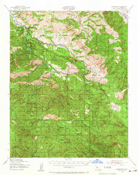
1939 Map of Jamesburg
USGS Topo · Published 1956About this map
Jamesburg sits at the heart of this 1939 survey, a period when the Santa Lucia Range was defined by remote cattle ranches and the burgeoning water infrastructure of Monterey County. The San Clemente Dam on the Carmel River appears in its early operational years, serving as a critical waypoint in a landscape dominated by the high ridges of Tularcitos Ridge and Los Tularcitos. Local educational life centers on the Tularcitos Sch, while rural homesteads such as Tularcitos Ranch and Bruce Ranch anchor the deep valleys.
Find a feature on this map
55 named features on this map. Tap any name to fly to it.
Don’t see what you’re looking for? This feature index may not catch every label — zoom into the map to look around manually.
Map Details
Editions of this 1939 Jamesburg Map
2 editions found
Other maps of this area

1910 · Gonzales
USGS Topo · 1:31,680

1910 · Salinas
USGS Topo · 1:31,680

1910 · Soledad
USGS Topo · 1:31,680

1912 · Salinas
USGS Topo · 1:62,500

1913 · Monterey
USGS Topo · 1:62,500

1915 · Soledad
USGS Topo · 1:62,500

1918 · Point Sur
USGS Topo · 1:62,500

1919 · Junipero Serra
USGS Topo · 1:62,500

1920 · Jamesburg
USGS Topo · 1:48,000

1921 · Jamesburg
USGS Topo · 1:62,500