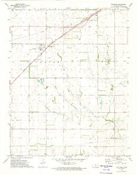
1972 Map of Partridge
USGS Topo · Published 1974About this map
The town of Partridge sits at the intersection of two major rail corridors in central Reno County, where the Atchison Topeka and Santa Fe and the Chicago Rock Island and Pacific lines converge. This 1972 survey illustrates a landscape deeply shaped by agricultural research and rural community infrastructure, featuring an Experimental Farm and a network of local institutions like the Eureka Sch and Plainview Ch. The topography is defined by the drainage of Red Rock Creek, which meanders through the southern townships of Troy and Castleton. Notable for genealogists, the map identifies several burial sites including Center Cem and a smaller Cem located just south of the main settlement, providing a clear record of the area's established social geography before modern consolidated farming changed the rural footprint.
Find a feature on this map
16 named features on this map. Tap any name to fly to it.
Don’t see what you’re looking for? This feature index may not catch every label — zoom into the map to look around manually.
Map Details
Editions of this 1972 Partridge Map
This is the sole edition of this map. No revisions or reprints were ever made.
Other maps of this area

1889 · Cheney
USGS Topo · 1:125,000

1891 · Hutchinson
USGS Topo · 1:125,000

1891 · Cheney
USGS Topo · 1:125,000

1892 · Kingman
USGS Topo · 1:125,000

1893 · Hutchinson
USGS Topo · 1:125,000

1894 · Kingman
USGS Topo · 1:125,000

1894 · Lyons
USGS Topo · 1:125,000

1901 · Cheney
USGS Topo · 1:125,000

1955 · Wichita
USGS Topo · 1:250,000

1955 · Great Bend
USGS Topo · 1:250,000