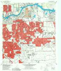
1982 Map of Pasadena
USGS Topo · Published 1983About this map
The Houston Ship Channel dominates the northern landscape of this industrial and residential corridor during the early 1980s, serving as the central artery for Jacintoport and the surrounding refineries. Between the dense neighborhoods of Pasadena and South Houston, a complex network of bayous including Buffalo Bayou, Sims Bayou, and Vince Bayou continues to shape the local geography despite heavy urban development.
Find a feature on this map
75 named features on this map. Tap any name to fly to it.
Don’t see what you’re looking for? This feature index may not catch every label — zoom into the map to look around manually.
Map Details
Editions of this 1982 Pasadena Map
This is the sole edition of this map. No revisions or reprints were ever made.
Other maps of this area

1915 · Park Place
USGS Topo · 1:24,000

1915 · Deepwater
USGS Topo · 1:24,000

1916 · Genoa
USGS Topo · 1:24,000

1916 · Burnett Bay
USGS Topo · 1:24,000

1916 · Settegast
USGS Topo · 1:24,000

1916 · Seabrook
USGS Topo · 1:24,000

1916 · Fauna
USGS Topo · 1:24,000

1916 · La Porte
USGS Topo · 1:24,000

1919 · Deepwater
USGS Topo · 1:31,680

1920 · Seabrook
USGS Topo · 1:31,680