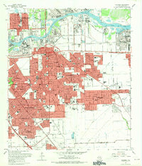
1967 Map of Pasadena
USGS Topo · Published 1970About this map
The industrial and residential growth of Harris County is on full display in this mid-century survey of Pasadena and its neighboring communities. Centered on the intensive shipping infrastructure along the Houston Ship Channel and Buffalo Bayou, the map captures a landscape transitioning from the traditional crossroads at Genoa to dense suburban expansion in Golden Acres and Allendale. The infrastructure reflects a booming civic life, evidenced by a dense network of educational and spiritual centers like Our Lady of Fatima Sch, Sam Rayburn High Sch, and the Bible Institute of Texas.
Find a feature on this map
76 named features on this map. Tap any name to fly to it.
Don’t see what you’re looking for? This feature index may not catch every label — zoom into the map to look around manually.
Map Details
Editions of this 1967 Pasadena Map
This is the sole edition of this map. No revisions or reprints were ever made.
Other maps of this area

1915 · Park Place
USGS Topo · 1:24,000

1915 · Deepwater
USGS Topo · 1:24,000

1916 · Genoa
USGS Topo · 1:24,000

1916 · Burnett Bay
USGS Topo · 1:24,000

1916 · Settegast
USGS Topo · 1:24,000

1916 · Seabrook
USGS Topo · 1:24,000

1916 · Fauna
USGS Topo · 1:24,000

1916 · La Porte
USGS Topo · 1:24,000

1919 · Deepwater
USGS Topo · 1:31,680

1920 · Seabrook
USGS Topo · 1:31,680