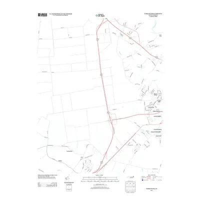
2013 Map of Pasquotank
USGS Topo · Published 2013About this map
The Pasquotank River and Little River frame this coastal plain landscape, showing the suburban expansion and rural heritage of Pasquotank County in the early 21st century. The map highlights a series of residential developments such as Forest Park, Ulster Gardens, and Oxford Heights, which stand in contrast to older established locales like Okisko and Mount Herman. Industrial and maritime ties are evident at Possum Quarter Landing and the Lumber Mill, marking the continued importance of the waterfront. The infrastructure is defined by modern bypasses and local routes like Chicken Corner Rd, reflecting the intersection of traditional agricultural land use and growing neighborhood clusters near Knobbs Cr.
Find a feature on this map
114 named features on this map. Tap any name to fly to it.
Don’t see what you’re looking for? This feature index may not catch every label — zoom into the map to look around manually.
Map Details
Editions of this 2013 Pasquotank Map
This is the sole edition of this map. No revisions or reprints were ever made.
Other maps of this area

1906 · Hertford
USGS Topo · 1:62,500

1940 · Hertford
USGS Topo · 1:62,500

1940 · Wade Point
USGS Topo · 1:62,500

1940 · South Mills
USGS Topo · 1:62,500

1943 · Wade Point
USGS Topo · 1:62,500

1948 · Wade Point
USGS Topo · 1:62,500

1948 · Elizabeth City
USGS Topo · 1:62,500

1952 · South Mills
USGS Topo · 1:62,500

1953 · Norfolk
USGS Topo · 1:250,000

1982 · Nixonton
USGS Topo · 1:24,000