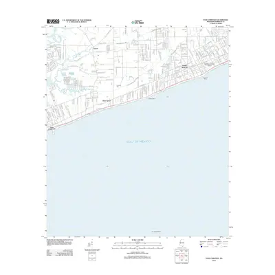
2012 Map of Pass Christian
USGS Topo · Published 2012About this map
The Mississippi Gulf Coast at the dawn of the 2010s reveals a dense landscape of coastal settlements and intricate waterways. This survey highlights the established shoreline communities of Long Beach and Pass Christian, separated by the smaller historic locales of Cuevas and White Harbor. A significant institutional presence is marked by the University of Southern Mississippi-Gulf Park Campus situated along the coastal front.
Find a feature on this map
73 named features on this map. Tap any name to fly to it.
Don’t see what you’re looking for? This feature index may not catch every label — zoom into the map to look around manually.
Map Details
Editions of this 2012 Pass Christian Map
This is the sole edition of this map. No revisions or reprints were ever made.
Other maps of this area

1893 · Cat Island
USGS Topo · 1:62,500

1893 · Toulme
USGS Topo · 1:62,500

1946 · Isle Au Pitre
USGS Topo · 1:31,680

1951 · Cat Island
USGS Topo · 1:24,000

1953 · Mobile
USGS Topo · 1:250,000

1954 · Isle Au Pitre
USGS Topo · 1:31,680

1954 · Gulfport North
USGS Topo · 1:24,000

1954 · Gulfport South
USGS Topo · 1:24,000

1955 · Pass Christian
USGS Topo · 1:24,000
1955 · Isle Au Pitre
USGS Topo · 1:24,000