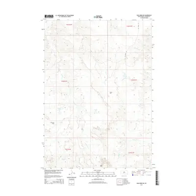
2015 Map of Pass Creek NE
USGS Topo · Published 2015About this map
Red Stone Basin and the surrounding high plains of Jackson County characterize this landscape as it appeared in the mid-2010s. The terrain is defined by a network of drainage systems, including Red Stone Cr, Paulmyer Cr, and Deep Cr, which carve through the topography toward the regional tablelands. Significant landforms like Brown Flat and the prominent Cedar Butte serve as primary landmarks in this sparsely populated region.
Find a feature on this map
20 named features on this map. Tap any name to fly to it.
Don’t see what you’re looking for? This feature index may not catch every label — zoom into the map to look around manually.
Map Details
Editions of this 2015 Pass Creek NE Map
This is the sole edition of this map. No revisions or reprints were ever made.
Other maps of this area

1951 · Pass Creek NW
USGS Topo · 1:24,000

1951 · Stamford SW
USGS Topo · 1:24,000

1951 · Belvidere
USGS Topo · 1:24,000

1951 · Belvidere SW
USGS Topo · 1:24,000

1951 · Cedar Butte NW
USGS Topo · 1:24,000

1951 · Pass Creek NE
USGS Topo · 1:24,000

1955 · Martin
USGS Topo · 1:250,000

1958 · Martin
USGS Topo · 1:250,000

1980 · Kadoka
USGS Topo · 1:100,000

1981 · Cedar Butte
USGS Topo · 1:25,000