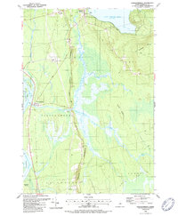
1988 Map of Passadumkeag
USGS Topo · Published 1988About this map
Penobscot River and the Passadumkeag River converge in this 1980s look at Penobscot County, a landscape defined by the winding paths of the water and the glacial ridges of the Horseback. The town of Passadumkeag sits at the river junction, serving as a hub for the local geography along with Enfield. This era shows a community deeply tied to its natural resources and land management, evidenced by the Fish Hatchery near Cold Stream Pond and the extensive State Nursery to the south. Local heritage is preserved in sites like West End Cemetery and Sunny Slope Cemetery, while transport history is marked by Enfield Station and the Hathaway Bridge. The varied terrain includes the expansive Thousand Acre Bog and the high point of Vinegar Hill, illustrating the complex hydrology of the Maine interior.
Find a feature on this map
40 named features on this map. Tap any name to fly to it.
Don’t see what you’re looking for? This feature index may not catch every label — zoom into the map to look around manually.
Map Details
Editions of this 1988 Passadumkeag Map
2 editions found
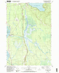
Other maps of this area

1917 · Passadumkeag
USGS Topo · 1:62,500

1920 · Winn
USGS Topo · 1:62,500

1931 · Saponac
USGS Topo · 1:48,000

1934 · Saponac
USGS Topo · 1:62,500

1942 · Lincoln
USGS Topo · 1:62,500

1954 · Millinocket
USGS Topo · 1:250,000

1957 · Lincoln
USGS Topo · 1:62,500

1957 · Saponac
USGS Topo · 1:62,500

1958 · Millinocket
USGS Topo · 1:250,000

1960 · Millinocket
USGS Topo · 1:250,000