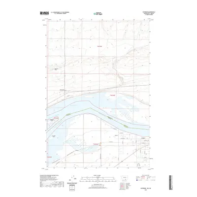
2020 Map of Paterson
USGS Topo · Published 2020About this map
Lake Umatilla dominates the center of this landscape, where the North Channel Columbia River and South Channel Columbia River bifurcate around Big Blalock Island and Long Walk Island. This section of the river serves as a critical boundary between Washington and Oregon, as well as Benton and Morrow Counties. On the northern banks, Paterson sits below the prominent Paterson Ridge, while to the southeast, the settlement of Irrigon is laid out in a grid of residential and local roads including Oregon Ave NW.
Find a feature on this map
32 named features on this map. Tap any name to fly to it.
Don’t see what you’re looking for? This feature index may not catch every label — zoom into the map to look around manually.
Map Details
Editions of this 2020 Paterson Map
This is the sole edition of this map. No revisions or reprints were ever made.
Other maps of this area

1906 · Blalock Island
USGS Topo · 1:125,000

1908 · Blalock Island
USGS Topo · 1:125,000

1908 · Umatilla
USGS Topo · 1:125,000

1915 · Prosser
USGS Topo · 1:125,000

1917 · Pasco
USGS Topo · 1:125,000

1917 · Prosser
USGS Topo · 1:125,000

1953 · Pendleton
USGS Topo · 1:250,000

1953 · Walla Walla
USGS Topo · 1:250,000

1956 · Pendleton
USGS Topo · 1:250,000

1958 · Walla Walla
USGS Topo · 1:250,000