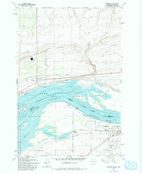
1993 Map of Paterson
USGS Topo · Published 1993About this map
Paterson and the surrounding Columbia River landscape appear in this 1993 edition, defined by the expansive waters of Lake Umatilla. The map detail follows the state boundary between Benton County, Washington and Morrow County, Oregon, highlighting a complex network of riverine environments. Much of the riverfront is managed under the Umatilla National Wildlife Refuge and the Paterson Slough Wildlife Refuge, protecting land around the Blalock Islands and the branching North Channel and South Channel.
Find a feature on this map
32 named features on this map. Tap any name to fly to it.
Don’t see what you’re looking for? This feature index may not catch every label — zoom into the map to look around manually.
Map Details
Editions of this 1993 Paterson Map
This is the sole edition of this map. No revisions or reprints were ever made.
Other maps of this area

1906 · Blalock Island
USGS Topo · 1:125,000

1908 · Blalock Island
USGS Topo · 1:125,000

1908 · Umatilla
USGS Topo · 1:125,000

1915 · Prosser
USGS Topo · 1:125,000

1917 · Pasco
USGS Topo · 1:125,000

1917 · Prosser
USGS Topo · 1:125,000

1953 · Pendleton
USGS Topo · 1:250,000

1953 · Walla Walla
USGS Topo · 1:250,000

1956 · Pendleton
USGS Topo · 1:250,000

1958 · Walla Walla
USGS Topo · 1:250,000