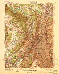
1938 Map of Paterson
USGS Topo · Published 1938About this map
The Passaic River anchors this pre-war survey, winding through the industrial heart of Paterson and East Paterson. The dense urban grid of the city, complete with the Post Office and City Hall, contrasts sharply with the western slopes of the Watchung Mountains. Higher elevations near High Mountain and the Garret Mountain Reservation reveal a landscape transitioning from wilder terrain to established institutions like St Michaels Orphanage and the North Jersey Training School.
Find a feature on this map
98 named features on this map. Tap any name to fly to it.
Don’t see what you’re looking for? This feature index may not catch every label — zoom into the map to look around manually.
Map Details
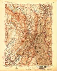
Editions of this 1938 Paterson Map
2 editions found
Other maps of this area

1888 · Morristown
USGS Topo · 1:62,500

1888 · Paterson
USGS Topo · 1:62,500

1891 · Greenwood Lake
USGS Topo · 1:62,500

1891 · Ramapo
USGS Topo · 1:62,500

1892 · Paterson
USGS Topo · 1:62,500

1893 · Greenwood Lake
USGS Topo · 1:62,500

1893 · Ramapo
USGS Topo · 1:62,500

1894 · Morristown
USGS Topo · 1:62,500

1898 · Morristown
USGS Topo · 1:62,500

1898 · Paterson
USGS Topo · 1:62,500