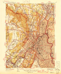
1944 Map of Paterson
USGS Topo · Published 1944About this map
The Passaic River anchors this mid-century view of industrial and residential expansion, winding through the heart of Paterson and West Paterson. The urban density of the city center, marked by landmarks like the Post Office and St Josephs Hospital, contrasts sharply with the wooded heights of Garret Mountain Reservation and the prominent peak of High Mtn. In the valley, the Dundee Canal and the tracks of the Erie RR and D L & W RR highlight the transportation infrastructure that fueled the region's textile and manufacturing legacy.
Find a feature on this map
80 named features on this map. Tap any name to fly to it.
Don’t see what you’re looking for? This feature index may not catch every label — zoom into the map to look around manually.
Map Details
Editions of this 1944 Paterson Map
2 editions found
Other maps of this area

1888 · Morristown
USGS Topo · 1:62,500

1888 · Paterson
USGS Topo · 1:62,500

1891 · Greenwood Lake
USGS Topo · 1:62,500

1891 · Ramapo
USGS Topo · 1:62,500

1892 · Paterson
USGS Topo · 1:62,500

1893 · Greenwood Lake
USGS Topo · 1:62,500

1893 · Ramapo
USGS Topo · 1:62,500

1894 · Morristown
USGS Topo · 1:62,500

1898 · Morristown
USGS Topo · 1:62,500

1898 · Paterson
USGS Topo · 1:62,500