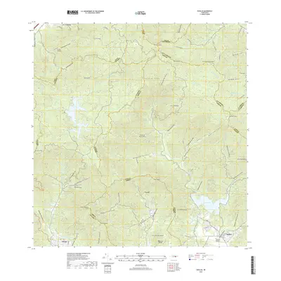
2018 Map of Patillas
USGS Topo · Published 2018About this map
Sierra de Cayey defines the interior highlands of this Puerto Rican landscape, where numerous peaks and mountain ridges divide the southern coastal plains from the northern reaches. The terrain is marked by high summits such as Cerro Lucero and Cerro La Santa, which oversee a complex network of waterways feeding into significant reservoirs. To the southeast, the Rio Grande de Patillas flows toward Lago Patillas, a central geographical feature that supports the surrounding agricultural and residential zones near the town of Patillas.
Find a feature on this map
77 named features on this map. Tap any name to fly to it.
Don’t see what you’re looking for? This feature index may not catch every label — zoom into the map to look around manually.
Map Details
Editions of this 2018 Patillas Map
This is the sole edition of this map. No revisions or reprints were ever made.
Other maps of this area

1945 · Punta Tuna
USGS Topo · 1:30,000

1945 · Central Aguirre
USGS Topo · 1:30,000

1946 · Patillas
USGS Topo · 1:30,000

1946 · Cayey
USGS Topo · 1:30,000

1946 · Comerio
USGS Topo · 1:30,000

1946 · Juncos
USGS Topo · 1:30,000

1946 · Yabucoa
USGS Topo · 1:30,000

1946 · Guayama
USGS Topo · 1:30,000

1946 · Caguas
USGS Topo · 1:30,000

1947 · Yabucoa SO
USGS Topo · 1:10,000
Featured Places
- Patillas
- Sector Hormiga, Patillas
- Sector Los Meléndez, Cayey
- Sector Conejo Blanco, Patillas
- Villa Kike, San Lorenzo