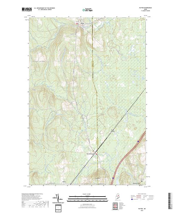
2024 Map of Patten
USGS Topo · Published 2024About this map
Patten serves as a northern anchor for this landscape where the Penobscot County and Aroostook County line divides the terrain. The area is defined by an extensive network of waterways, including the West Branch and East Branch Molunkus Streams, which drain through sprawling wetlands like Thousand Acre Bog and Blackwell Bog. These natural features dictated the early settlement patterns and the placement of transportation routes such as Station Rd and S Patten Rd. To the south, the village of Sherman Mills sits near the Sherman Mills Cemetery, while smaller locales like Siberia and Sherman Station suggest the varied history of this timber-and-agricultural region. Elevation is marked by prominent high points such as Ash Hill and Stafford Hill, providing a clear view of the drainage basins and the many brooks, including Fish Stream and Torrie Brook, that feed the larger Molunkus system.
Find a feature on this map
46 named features on this map. Tap any name to fly to it.
Don’t see what you’re looking for? This feature index may not catch every label — zoom into the map to look around manually.
Map Details
Editions of this 2024 Patten Map
This is the sole edition of this map. No revisions or reprints were ever made.
Other maps of this area

1940 · Island Falls
USGS Topo · 1:62,500

1940 · Sherman
USGS Topo · 1:62,500

1942 · Island Falls
USGS Topo · 1:62,500

1942 · Sherman
USGS Topo · 1:62,500

1953 · Stacyville
USGS Topo · 1:62,500

1954 · Shin Pond
USGS Topo · 1:62,500

1954 · Presque Isle
USGS Topo · 1:250,000

1954 · Millinocket
USGS Topo · 1:250,000

1958 · Presque Isle
USGS Topo · 1:250,000

1958 · Millinocket
USGS Topo · 1:250,000