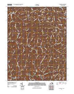
2011 Map of Patterson
USGS Topo · Published 2011About this map
Patterson and the surrounding Buchanan County settlements are defined by the winding paths of Slate Creek and Dismal Creek in this 2011 record. The landscape is a network of ridges and hollows, where narrow valley floors provide just enough space for communities like Slate, Dwight, and Hale Creek. These small clusters of dwellings often developed at the confluences of minor branches, such as where Dry Tripe Branch meets the main creek near the Rife Cemetery.
Find a feature on this map
104 named features on this map. Tap any name to fly to it.
Don’t see what you’re looking for? This feature index may not catch every label — zoom into the map to look around manually.
Map Details
Editions of this 2011 Patterson Map
This is the sole edition of this map. No revisions or reprints were ever made.
Other maps of this area

1886 · Grundy
USGS Topo · 1:125,000

1890 · Grundy
USGS Topo · 1:125,000

1891 · Tazewell
USGS Topo · 1:125,000

1892 · Grundy
USGS Topo · 1:125,000

1895 · Tazewell
USGS Topo · 1:125,000

1897 · Tazewell
USGS Topo · 1:125,000

1910 · Iaeger
USGS Topo · 1:48,000

1912 · Iaeger
USGS Topo · 1:62,500

1914 · Bucu
USGS Topo · 1:48,000

1914 · Iaeger
USGS Topo · 1:48,000