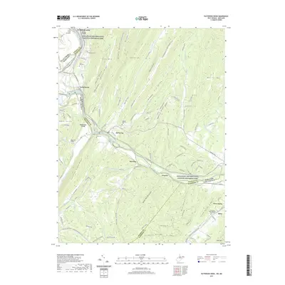
2019 Map of Patterson Creek
USGS Topo · Published 2019About this map
The North Branch Potomac River serves as the central artery and border between Maryland and West Virginia in this 2019 survey, defining a landscape of narrow river bottoms and steep ridges. The corridor is dominated by the Chesapeake and Ohio Canal National Historical Park, where the preserved engineering of the Evitts Creek Aqueduct stands near the outskirts of Cumberland. Settlement patterns follow the river and rail lines, with small communities like Spring Gap and Patterson Creek clustered near the CSX Transportation tracks. Local genealogy is well-represented through several rural burial grounds, including Saint Marys Cem and the Forest Glen United Methodist Church Cem. The terrain rises sharply from the river to prominent landforms such as Irons Mtn and Warrior Mtn, split by deep hollows like Wildcat Hollow and Frog Hollow.
Find a feature on this map
126 named features on this map. Tap any name to fly to it.
Don’t see what you’re looking for? This feature index may not catch every label — zoom into the map to look around manually.
Map Details
Editions of this 2019 Patterson Creek Map
This is the sole edition of this map. No revisions or reprints were ever made.
Other maps of this area

1891 · Romney
USGS Topo · 1:125,000

1898 · Frostburg
USGS Topo · 1:62,500

1899 · Flintstone
USGS Topo · 1:62,500

1900 · Flintstone
USGS Topo · 1:62,500

1901 · Frostburg
USGS Topo · 1:62,500

1908 · Frostburg
USGS Topo · 1:62,500

1920 · Keyser
USGS Topo · 1:62,500

1921 · Keyser
USGS Topo · 1:48,000

1921 · Hanging Rock
USGS Topo · 1:48,000

1922 · Keyser
USGS Topo · 1:62,500