Loading...
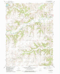
Loading map...1983 Map of Patterson
USGS Topo · Published 1984About this map
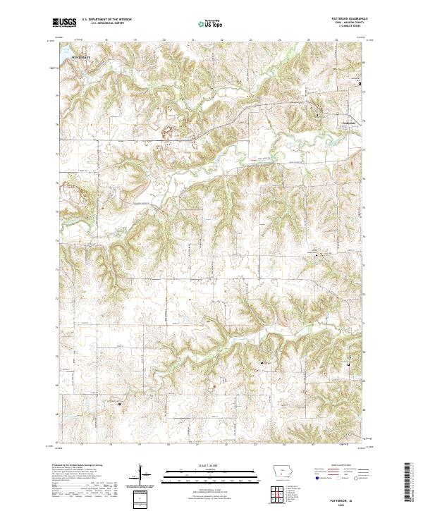
The town of Patterson is the central hub of this Iowa survey, which captures the rural landscape at a time when traditional landmarks and early transit routes were still prominent. The Middle River and Cedar Creek carve through the townships of Union, Crawford, and Scott, defining a terrain dotted with numerous family and community cemeteries such as Montpelier Cem and Beardsley Cem.
Find a feature on this map
28 named features on this map. Tap any name to fly to it.
Don’t see what you’re looking for? This feature index may not catch every label — zoom into the map to look around manually.
Map Details
Date Portrayed1983
Date Published1984
PublisherU.S. Geological Survey
Map TypeTopographic
Scale1:24,000
Physical Dimensions21.9 x 26.8 inches
Editions of this 1983 Patterson Map
This is the sole edition of this map. No revisions or reprints were ever made.
Historical Maps of Winterset Through Time
6 maps found
Featured Locations
Source Details
SourceU.S. Geological Survey
CopyrightPublic Domain