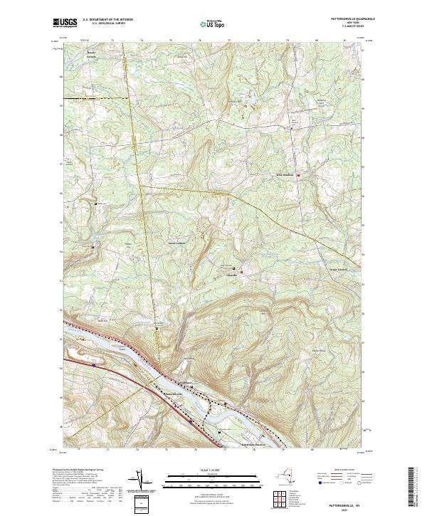
2023 Map of Pattersonville
USGS Topo · Published 2023About this map
The Mohawk River serves as the central corridor for this 2023 landscape, where the CSX railroad and Mohawk Tpke parallel the water through Pattersonville and Rotterdam Junction. This map captures a intersection of four counties—Schenectady, Montgomery, Saratoga, and Fulton—highlighting the transition from the river valley to the upland terrain of Glenville Hill and Jersey Hill.
Find a feature on this map
107 named features on this map. Tap any name to fly to it.
Don’t see what you’re looking for? This feature index may not catch every label — zoom into the map to look around manually.
Map Details
Editions of this 2023 Pattersonville Map
This is the sole edition of this map. No revisions or reprints were ever made.
Other maps of this area

1893 · Schenectady
USGS Topo · 1:62,500

1895 · Schenectady
USGS Topo · 1:62,500

1895 · Amsterdam
USGS Topo · 1:62,500

1898 · Schenectady
USGS Topo · 1:62,500

1899 · Broadalbin
USGS Topo · 1:62,500

1902 · Broadalbin
USGS Topo · 1:62,500

1902 · Saratoga
USGS Topo · 1:62,500

1930 · Schenectady
USGS Topo · 1:62,500

1931 · Amsterdam
USGS Topo · 1:62,500

1935 · Middle Grove
USGS Topo · 1:24,000