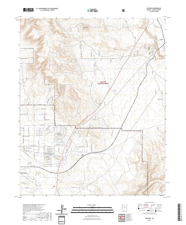
2021 Map of Paulden
USGS Topo · Published 2021About this map
Paulden and the northern reaches of the Big Chino Valley define this Yavapai County landscape, where the high desert terrain meets the southwestern edge of the Prescott National Forest. The map documents a rural network of ranching roads and water management features, including numerous stock tanks like Peavine Tank and Railroad Tank, which were vital for supporting livestock in the arid grasslands. The settlement of Abra sits at a junction of early transportation routes, while the eastern edge of the quadrangle is marked by the descent into Limestone Canyon and the headwaters of the Verde River. For genealogists and local historians, the presence of the Puntenney Cem near Drake offers a connection to the area's early families and pioneer-era burials. The topography is dominated by large landforms such as Big Black Mesa and Rock Butte, providing a clear view of the natural boundaries that shaped early development and land use in this part of Arizona.
Find a feature on this map
70 named features on this map. Tap any name to fly to it.
Don’t see what you’re looking for? This feature index may not catch every label — zoom into the map to look around manually.
Map Details
Editions of this 2021 Paulden Map
This is the sole edition of this map. No revisions or reprints were ever made.
Other maps of this area

1886 · Chino
USGS Topo · 1:250,000

1887 · Prescott
USGS Topo · 1:250,000

1891 · Chino
USGS Topo · 1:250,000

1892 · Prescott
USGS Topo · 1:250,000

1905 · Jerome
USGS Topo · 1:125,000

1922 · Williams
USGS Topo · 1:125,000

1947 · Ash Fork
USGS Topo · 1:62,500

1947 · Simmons
USGS Topo · 1:62,500

1947 · Picacho Butte
USGS Topo · 1:62,500

1947 · Paulden
USGS Topo · 1:62,500