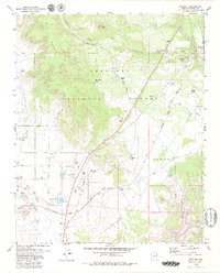
1979 Map of Paulden
USGS Topo · Published 1979About this map
Prescott National Forest dominates the high desert terrain of central Arizona, where the massive plateau of Black Mesa meets the deep cuts of Limestone Canyon and Hell Canyon. In the late 1970s, the community of Paulden and the rail junction at Drake served as primary touchpoints for this transition between the Chino Valley grasslands and the timbered forest. The landscape is heavily marked by the legacy of Western transportation, defined by the active Atchison Topeka and Santa Fe Railroad and remnants of the past visible as an Old Railroad Grade. This transport network supported a local economy of resource extraction, evidenced by scattered Borrow Pits, Quarries, and a Cinder Pit. Water management is central to life here, with named improvements like Hells Well, Peavine Tank, and Roper Tank providing essential water sources across the arid valleys and limestone reaches.
Find a feature on this map
35 named features on this map. Tap any name to fly to it.
Don’t see what you’re looking for? This feature index may not catch every label — zoom into the map to look around manually.
Map Details
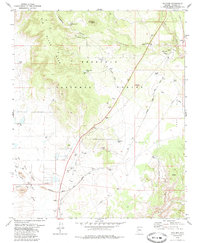
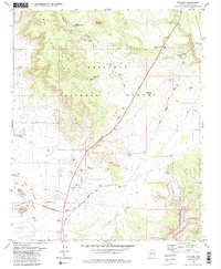
Editions of this 1979 Paulden Map
3 editions found
Other maps of this area

1886 · Chino
USGS Topo · 1:250,000

1887 · Prescott
USGS Topo · 1:250,000

1891 · Chino
USGS Topo · 1:250,000

1892 · Prescott
USGS Topo · 1:250,000

1905 · Jerome
USGS Topo · 1:125,000

1922 · Williams
USGS Topo · 1:125,000

1947 · Ash Fork
USGS Topo · 1:62,500

1947 · Simmons
USGS Topo · 1:62,500

1947 · Picacho Butte
USGS Topo · 1:62,500

1947 · Paulden
USGS Topo · 1:62,500