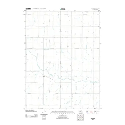
2011 Map of Pauline
USGS Topo · Published 2011About this map
Pauline sits at the heart of this agricultural landscape in Adams and Clay Counties, where the grid of modern section roads preserves the memory of historic westward movement. The northern edge of the map is defined by E Oregon Trail Rd, tracing the corridor of the nineteenth-century pioneer route, while E Pony Express Rd bisects the center of the sheet, reflecting the area's significance in early American transcontinental communication. The drainage pattern is dominated by the winding path of the Little Blue River, which receives tributaries like Ash Creek and Pawnee Creek. This 2011 survey captures the region's rural character, punctuated by landmarks such as the Munsterman Airport and a network of arterial roads including S Showboat Blvd and S Blaine Ave that connect the small settlement of Pauline to the surrounding prairie.
Find a feature on this map
34 named features on this map. Tap any name to fly to it.
Don’t see what you’re looking for? This feature index may not catch every label — zoom into the map to look around manually.
Map Details
Editions of this 2011 Pauline Map
This is the sole edition of this map. No revisions or reprints were ever made.
Other maps of this area

1898 · Superior
USGS Topo · 1:125,000

1898 · Grand Island
USGS Topo · 1:125,000

1955 · Grand Island
USGS Topo · 1:250,000

1957 · Grand Island
USGS Topo · 1:250,000

1958 · Grand Island
USGS Topo · 1:250,000

1960 · Deweese
USGS Topo · 1:24,000

1969 · Hastings East
USGS Topo · 1:24,000

1969 · Fairfield NW
USGS Topo · 1:24,000

1969 · Lawrence
USGS Topo · 1:24,000

1969 · Blue Hill
USGS Topo · 1:24,000