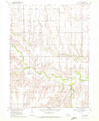
1969 Map of Pauline
USGS Topo · Published 1972About this map
The Little Blue River winds through the southern portion of this landscape, anchoring a rural territory where the Missouri Pacific railroad once played a central role in local transport. The small settlement of Pauline serves as the primary community hub, positioned near the river's bend and several industrial Sandpit sites. The surrounding countryside is divided into named townships like Hanover and Glenville, where the presence of Hanover Ch, Cem, and School No 75 indicates the established social fabric of these Nebraska farming communities.
Find a feature on this map
19 named features on this map. Tap any name to fly to it.
Don’t see what you’re looking for? This feature index may not catch every label — zoom into the map to look around manually.
Map Details
Editions of this 1969 Pauline Map
This is the sole edition of this map. No revisions or reprints were ever made.
Other maps of this area

1898 · Superior
USGS Topo · 1:125,000

1898 · Grand Island
USGS Topo · 1:125,000

1955 · Grand Island
USGS Topo · 1:250,000

1957 · Grand Island
USGS Topo · 1:250,000

1958 · Grand Island
USGS Topo · 1:250,000

1960 · Deweese
USGS Topo · 1:24,000

1969 · Hastings East
USGS Topo · 1:24,000

1969 · Fairfield NW
USGS Topo · 1:24,000

1969 · Lawrence
USGS Topo · 1:24,000

1969 · Blue Hill
USGS Topo · 1:24,000