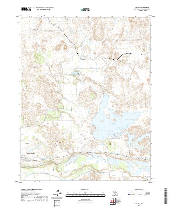
2021 Map of Paulsell
USGS Topo · Published 2021About this map
The Tuolumne River winds through the southern portion of this Stanislaus County landscape, serving as a vital artery for the region's complex irrigation network. This survey illustrates the intricate water management systems of the Central Valley, where the Waterford Lower Main Canal, Modesto Main Canal, and Turlock Main Canal diverge to support local agriculture. The settlement of Waterford sits at the southwestern edge, while the smaller locale of Paulsell is situated further north along the Paulsell Extension.
Find a feature on this map
35 named features on this map. Tap any name to fly to it.
Don’t see what you’re looking for? This feature index may not catch every label — zoom into the map to look around manually.
Map Details
Editions of this 2021 Paulsell Map
This is the sole edition of this map. No revisions or reprints were ever made.
Other maps of this area

1913 · Dickenson
USGS Topo · 1:31,680

1915 · Oakdale
USGS Topo · 1:31,680

1915 · Paulsell
USGS Topo · 1:31,680

1916 · Three Tree Flat
USGS Topo · 1:31,680

1916 · Montpellier
USGS Topo · 1:31,680

1916 · Cooperstown
USGS Topo · 1:31,680

1916 · Denair
USGS Topo · 1:31,680

1916 · Waterford
USGS Topo · 1:31,680

1916 · Copperopolis
USGS Topo · 1:62,500

1939 · Modesto East
USGS Topo · 1:62,500