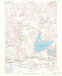
1968 Map of Paulsell
USGS Topo · Published 1971About this map
The Modesto Reservoir dominates the landscape of eastern Stanislaus County, serving as a critical hub for water management and recreation. This survey reveals a complex network of agricultural infrastructure, where the Modesto Main Canal and Turlock Main Canal flank the Tuolumne River to support the region's farms. Along the riverbanks, large deposits of Dredge Tailings and a Gravel Pit near Waterford reflect the area's history of resource extraction.
Find a feature on this map
41 named features on this map. Tap any name to fly to it.
Don’t see what you’re looking for? This feature index may not catch every label — zoom into the map to look around manually.
Map Details
Editions of this 1968 Paulsell Map
2 editions found
Other maps of this area

1913 · Dickenson
USGS Topo · 1:31,680

1915 · Oakdale
USGS Topo · 1:31,680

1915 · Paulsell
USGS Topo · 1:31,680

1916 · Three Tree Flat
USGS Topo · 1:31,680

1916 · Montpellier
USGS Topo · 1:31,680

1916 · Cooperstown
USGS Topo · 1:31,680

1916 · Denair
USGS Topo · 1:31,680

1916 · Waterford
USGS Topo · 1:31,680

1916 · Copperopolis
USGS Topo · 1:62,500

1939 · Modesto East
USGS Topo · 1:62,500