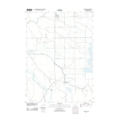
2012 Map of Pavillion
USGS Topo · Published 2012About this map
Pavillion serves as the primary hub in this agricultural landscape of Fremont County, defined by an intricate network of irrigation and water management systems. The map details the vital role of the Wyoming Canal, Aragon Ditch, and Johnstown Ditch in transforming the arid terrain of the Kinnear Valley. These engineered waterways, alongside features like the Pilot Drain and Sunnyside Drain, allow for cultivation between landmarks such as Sand Butte and the rising elevation of Big Ridge. To the west, the Wind River snakes through the valley, while the eastern edge of the quadrangle touches the shores of Ocean Lake. Local history is anchored by the Aragon Cem, a notable site for genealogical research situated amidst the rural roads. The grid of service routes, including Service Canal Rd and Sand Butte Rd, highlights the systematic development of the region's ranching and farming infrastructure.
Find a feature on this map
41 named features on this map. Tap any name to fly to it.
Don’t see what you’re looking for? This feature index may not catch every label — zoom into the map to look around manually.
Map Details
Editions of this 2012 Pavillion Map
This is the sole edition of this map. No revisions or reprints were ever made.
Other maps of this area

1950 · Pavillion
USGS Topo · 1:24,000

1950 · Pavillion Butte
USGS Topo · 1:24,000

1950 · Harris Bridge
USGS Topo · 1:24,000

1950 · Ocean Lake
USGS Topo · 1:24,000

1951 · Mule Butte
USGS Topo · 1:24,000

1951 · Pavillion SE
USGS Topo · 1:24,000

1951 · Morton
USGS Topo · 1:24,000

1951 · Lookout Butte
USGS Topo · 1:24,000

1951 · Ethete
USGS Topo · 1:24,000

1955 · Thermopolis
USGS Topo · 1:250,000