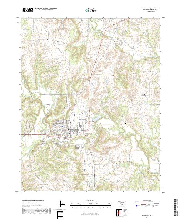
2022 Map of Pawhuska
USGS Topo · Published 2022About this map
The tribal and civic seat of Pawhuska is the central focus of this 2022 survey, showing the density of Osage County's government and cultural landscape. The Osage County Courthouse stands as a primary landmark within the grid of streets like Wakon Iron Blvd and E Main St. The surrounding terrain is defined by a dendritic network of waterways, including the winding Bird Creek and its many tributaries such as Sand Creek and Middle Bird Cr. Genealogists and local historians can locate several burial grounds on the outskirts of the town, from the large Pawhuska City Cem to the more outlying Lookout Cem and Strikeaxe Cem. The landscape reflects a mix of modern infrastructure and traditional land divisions, with the Public Land Survey System grids of t26n r9e and t25n r9e providing a framework for the rural roads and creek crossings that characterize this part of the Oklahoma prairie.
Find a feature on this map
68 named features on this map. Tap any name to fly to it.
Don’t see what you’re looking for? This feature index may not catch every label — zoom into the map to look around manually.
Map Details
Editions of this 2022 Pawhuska Map
This is the sole edition of this map. No revisions or reprints were ever made.
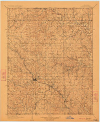
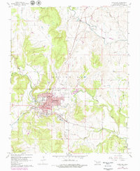
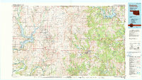
Historical Maps of Osage County Through Time
5 maps found