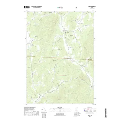
2018 Map of Pawlet
USGS Topo · Published 2018About this map
The Mettawee River valley and the surrounding peaks of the Green Mountain National Forest define the landscape of this portion of Rutland and Bennington Counties. The village of Pawlet serves as a central hub, situated near the confluence of Flower Brook and the river, while the settlements of North Rupert, Rupert, and East Rupert are clustered to the south along Mill Brook. This area is characterized by significant topographic relief, with prominent heights such as Scott Mtn, Rupert Mtn, and Antone Mtn rising above the agricultural valley floors. Genealogists will find a wealth of specific local history in the numerous burial sites across the quadrangle, including the Mettawee Valley Cem, Graves Family Cem, and the Rupert Street Cem located near the town center. Local transportation is represented by a network of rural roads and the small Hulett Landing Strip near Indian River.
Find a feature on this map
84 named features on this map. Tap any name to fly to it.
Don’t see what you’re looking for? This feature index may not catch every label — zoom into the map to look around manually.
Map Details
Editions of this 2018 Pawlet Map
This is the sole edition of this map. No revisions or reprints were ever made.
Other maps of this area

1893 · Fort Ann
USGS Topo · 1:62,500

1894 · Pawlet
USGS Topo · 1:62,500

1894 · Equinox
USGS Topo · 1:62,500

1895 · Cambridge
USGS Topo · 1:62,500

1895 · Fort Ann
USGS Topo · 1:62,500

1896 · Equinox
USGS Topo · 1:62,500

1897 · Pawlet
USGS Topo · 1:62,500

1898 · Cambridge
USGS Topo · 1:62,500

1898 · Fort Ann
USGS Topo · 1:62,500

1900 · Equinox
USGS Topo · 1:62,500