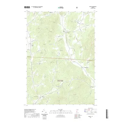
2021 Map of Pawlet
USGS Topo · Published 2021About this map
The Mettawee River valley anchors this Vermont landscape, carving a path through the Taconic Mountains as it flows through Pawlet and North Rupert. This modern survey reveals a mosaic of high peaks and deep hollows, such as Rush Hollow and The Pattern, where small family-named cemeteries like Graves Family Cem and the North Rupert Cem speak to generations of local settlement. The eastern half of the map is dominated by the steep, forested slopes of the Green Mountain National Forest, while the valley floor maintains its agricultural and residential character. Significant heights including Scott Mtn and Antone Mtn overlook the village centers, while the Hulett Landing Strip provides a small aviation landmark along the Indian River on the western edge of the quadrangle.
Find a feature on this map
84 named features on this map. Tap any name to fly to it.
Don’t see what you’re looking for? This feature index may not catch every label — zoom into the map to look around manually.
Map Details
Editions of this 2021 Pawlet Map
This is the sole edition of this map. No revisions or reprints were ever made.
Other maps of this area

1893 · Fort Ann
USGS Topo · 1:62,500

1894 · Pawlet
USGS Topo · 1:62,500

1894 · Equinox
USGS Topo · 1:62,500

1895 · Cambridge
USGS Topo · 1:62,500

1895 · Fort Ann
USGS Topo · 1:62,500

1896 · Equinox
USGS Topo · 1:62,500

1897 · Pawlet
USGS Topo · 1:62,500

1898 · Cambridge
USGS Topo · 1:62,500

1898 · Fort Ann
USGS Topo · 1:62,500

1900 · Equinox
USGS Topo · 1:62,500