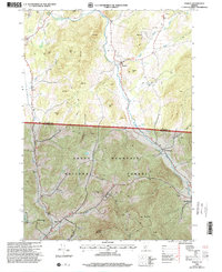
1995 Map of Pawlet
USGS Topo · Published 2000About this map
The Mettawee River valley serves as the central artery for this Vermont landscape, where the agricultural flats meet the rising peaks of the Green Mountain National Forest. In the mid-1990s, the village of Pawlet stands at the confluence of the river and Flower Brook, with local history reflected in landmarks like the Mettawee Valley Cem and Sargent Hill. The rugged southern terrain is dominated by Antone Mountain and The Gallop, while several Quarries and Gravel Pits indicate the area's continued reliance on stone and mineral extraction. Transportation and utility are marked by the presence of Mach Airfield in the north and the cluster of settlements including North Rupert, East Rupert, and Rupert following the river and Youlin Road south through the valley.
Find a feature on this map
38 named features on this map. Tap any name to fly to it.
Don’t see what you’re looking for? This feature index may not catch every label — zoom into the map to look around manually.
Map Details
Editions of this 1995 Pawlet Map
This is the sole edition of this map. No revisions or reprints were ever made.
Other maps of this area

1893 · Fort Ann
USGS Topo · 1:62,500

1894 · Pawlet
USGS Topo · 1:62,500

1894 · Equinox
USGS Topo · 1:62,500

1895 · Cambridge
USGS Topo · 1:62,500

1895 · Fort Ann
USGS Topo · 1:62,500

1896 · Equinox
USGS Topo · 1:62,500

1897 · Pawlet
USGS Topo · 1:62,500

1898 · Cambridge
USGS Topo · 1:62,500

1898 · Fort Ann
USGS Topo · 1:62,500

1900 · Equinox
USGS Topo · 1:62,500