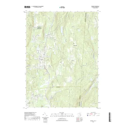
2019 Map of Pawling
USGS Topo · Published 2019About this map
Appalachian National Scenic Trail winds through the high ground of the Harlem Valley in this modern survey, marking a corridor of protected landscape between New York and Connecticut. The village of Pawling serves as a primary local hub, where the Swamp River and the East Branch Croton River converge near the extensive wetlands of The Great Swamp. This area is characterized by a high concentration of ancestral sites, including the Quaker Hill Cem and the Akin Family Burial Ground, which reflect the long-standing settlement of the ridge. To the south, Patterson is situated near the Maple Avenue Cem and the Old Baptist Burying Ground. The map also details numerous upland water bodies such as Lake Mauweehoo and Timber Lake along the state border, showing the dense network of roads and reservoirs that define the contemporary character of Dutchess and Putnam Counties.
Find a feature on this map
49 named features on this map. Tap any name to fly to it.
Don’t see what you’re looking for? This feature index may not catch every label — zoom into the map to look around manually.
Map Details
Editions of this 2019 Pawling Map
This is the sole edition of this map. No revisions or reprints were ever made.
Other maps of this area

1892 · Danbury
USGS Topo · 1:62,500

1892 · New Milford
USGS Topo · 1:62,500

1892 · Carmel
USGS Topo · 1:62,500

1893 · Carmel
USGS Topo · 1:62,500

1893 · New Milford
USGS Topo · 1:62,500

1893 · Clove
USGS Topo · 1:62,500

1894 · Clove
USGS Topo · 1:62,500

1894 · Carmel
USGS Topo · 1:62,500

1898 · Clove
USGS Topo · 1:62,500

1901 · Clove
USGS Topo · 1:62,500