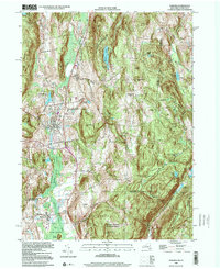
1998 Map of Pawling
USGS Topo · Published 2000About this map
Quaker Hill and the surrounding highlands of the Hudson Valley dominate this late 20th-century landscape, where established settlements like Pawling and Patterson sit at the edge of the wetlands known as The Great Swamp. The map reflects a long history of settlement and education, notably featuring the Trinity-Pawling Sch and a historic Meeting House near Quaker Lake. Transportation and recreation are etched into the terrain via the Penn Central rail line and a segment of the Appalachian National Scenic Trail winding through Hammersly Ridge and past Corbin Hill. Along the state line between New York and Connecticut, the environment remains largely protected within the Cranberry Mountain State Multiple Use Area. Local geography is defined by family-named landmarks and rural crossroads such as Hurd Corners, Baker Corner, and Akins Corners, which mark the intersections of the region's agricultural past and suburban present.
Find a feature on this map
56 named features on this map. Tap any name to fly to it.
Don’t see what you’re looking for? This feature index may not catch every label — zoom into the map to look around manually.
Map Details
Editions of this 1998 Pawling Map
This is the sole edition of this map. No revisions or reprints were ever made.
Other maps of this area

1892 · Danbury
USGS Topo · 1:62,500

1892 · New Milford
USGS Topo · 1:62,500

1892 · Carmel
USGS Topo · 1:62,500

1893 · Carmel
USGS Topo · 1:62,500

1893 · New Milford
USGS Topo · 1:62,500

1893 · Clove
USGS Topo · 1:62,500

1894 · Clove
USGS Topo · 1:62,500

1894 · Carmel
USGS Topo · 1:62,500

1898 · Clove
USGS Topo · 1:62,500

1901 · Clove
USGS Topo · 1:62,500