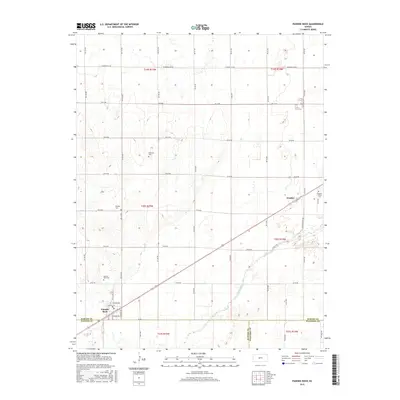
2015 Map of Pawnee Rock
USGS Topo · Published 2015About this map
Pawnee Rock stands as the central landmark of this Barton County landscape, situated near the intersection of the Barton Co Pawnee Co line. The settlement pattern here follows the path of the Arkansas River, which flows through the southeastern portion of the quadrangle. A series of historic burial grounds, including Rockville Cem, Bergtal Cem, and Pawnee Rock Cem, are distributed across the section lines, reflecting the established rural communities of the region. The small community of Dundee is positioned to the northeast, supported by the Dundee Valley Cem and proximity to the river. Within the town of Pawnee Rock, the street grid is clearly defined by historical names such as Bismark Ave and Santa Fe Ave, while Ash Cr drains the southern territory across the Pawnee Co Stafford Co border.
Find a feature on this map
52 named features on this map. Tap any name to fly to it.
Don’t see what you’re looking for? This feature index may not catch every label — zoom into the map to look around manually.
Map Details
Editions of this 2015 Pawnee Rock Map
This is the sole edition of this map. No revisions or reprints were ever made.
Other maps of this area

1889 · Larned
USGS Topo · 1:125,000

1891 · Great Bend
USGS Topo · 1:125,000

1891 · Larned
USGS Topo · 1:125,000

1893 · Great Bend
USGS Topo · 1:125,000

1955 · Great Bend
USGS Topo · 1:250,000

1957 · Great Bend
USGS Topo · 1:250,000

1958 · Great Bend
USGS Topo · 1:250,000

1958 · Great Bend
USGS Topo · 1:24,000

1959 · Great Bend NE
USGS Topo · 1:24,000

1960 · Pawnee Rock
USGS Topo · 1:24,000