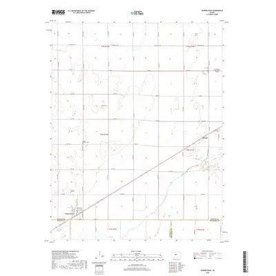
2018 Map of Pawnee Rock
USGS Topo · Published 2018About this map
Pawnee Rock stands as a prominent landmark on this central Kansas landscape, marking a site deeply tied to the history of the Santa Fe Trail. The settlement of Dundee occupies the eastern portion of the map, situated along a transportation corridor that parallels the Arkansas River. This river valley, supported by tributaries like Ash Cr, forms the primary geographic orientation for the region's agricultural layout, evidenced by the dense network of rural roads such as W Barton Co Rd and Coline Rd.
Find a feature on this map
48 named features on this map. Tap any name to fly to it.
Don’t see what you’re looking for? This feature index may not catch every label — zoom into the map to look around manually.
Map Details
Editions of this 2018 Pawnee Rock Map
This is the sole edition of this map. No revisions or reprints were ever made.
Other maps of this area

1889 · Larned
USGS Topo · 1:125,000

1891 · Great Bend
USGS Topo · 1:125,000

1891 · Larned
USGS Topo · 1:125,000

1893 · Great Bend
USGS Topo · 1:125,000

1955 · Great Bend
USGS Topo · 1:250,000

1957 · Great Bend
USGS Topo · 1:250,000

1958 · Great Bend
USGS Topo · 1:250,000

1958 · Great Bend
USGS Topo · 1:24,000

1959 · Great Bend NE
USGS Topo · 1:24,000

1960 · Pawnee Rock
USGS Topo · 1:24,000