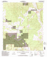
1995 Map of Paxton Springs
USGS Topo · Published 1998About this map
The Continental Divide winds through this high-elevation landscape within the Zuni Mountains, where the settlement of Paxton Springs sits near the namesake Paxton Spring. The map documents a complex geography of volcanic features and canyons, including Bandera Crater and the rugged basalt flows of El Malpais National Monument and the El Malpais National Conservation Area. Evidence of historical land use and industry is visible in the Old Railroad Grade and various extraction sites like the Cinder Pit and several Gravel Pits.
Find a feature on this map
30 named features on this map. Tap any name to fly to it.
Don’t see what you’re looking for? This feature index may not catch every label — zoom into the map to look around manually.
Map Details
Editions of this 1995 Paxton Springs Map
This is the sole edition of this map. No revisions or reprints were ever made.
Other maps of this area

1883 · Mt. Taylor
USGS Topo · 1:250,000

1886 · Wingate
USGS Topo · 1:250,000

1886 · Mt. Taylor
USGS Topo · 1:250,000

1892 · Wingate
USGS Topo · 1:250,000

1892 · Mt. Taylor
USGS Topo · 1:250,000

1899 · Mt. Taylor
USGS Topo · 1:250,000

1917 · Broom Mountain
USGS Topo · 1:125,000

1951 · Mt Sedgwick
USGS Topo · 1:24,000

1952 · Valle Largo
USGS Topo · 1:24,000

1952 · Post Office Flat
USGS Topo · 1:24,000