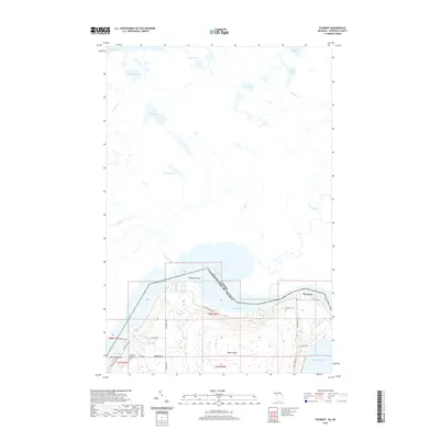
2019 Map of Payment
USGS Topo · Published 2019About this map
Saint Marys River serves as the international boundary dividing the United States and Canada in this northern borderland. The landscape is dominated by the northern reaches of Sugar Island, where small settlements like Payment and Brassar are connected by a network of local roads including E Northshore Dr and S Westmore Dr. The topography reveals a transition from the marshy lowlands of Masta Bay and Sucker Cr to the more inland, lake-dotted terrain of the Algoma District. Genealogists will find significance in the presence of the Payment Cem and Brassar Road Cem, which anchor these isolated communities. To the north, a dense cluster of water bodies including Crystal Lake, Belleau Lake, and Maud Lake defines the wilderness character of the Ontario side, while the southern edge of the map opens into the expansive waters of Lake Huron.
Find a feature on this map
43 named features on this map. Tap any name to fly to it.
Don’t see what you’re looking for? This feature index may not catch every label — zoom into the map to look around manually.
Map Details
Editions of this 2019 Payment Map
This is the sole edition of this map. No revisions or reprints were ever made.
Other maps of this area

1913 · Sault Sainte Marie
USGS Topo · 1:62,500

1919 · Neebish
USGS Topo · 1:62,500

1941 · Neebish
USGS Topo · 1:63,360

1941 · Sault Sainte Marie
USGS Topo · 1:63,360

1951 · Baie De Wasai
USGS Topo · 1:24,000

1951 · Sault Ste. Marie
USGS Topo · 1:62,500

1951 · Sault Ste. Marie South
USGS Topo · 1:24,000

1951 · Payment
USGS Topo · 1:24,000

1951 · Lake George
USGS Topo · 1:62,500

1954 · Sault Sainte Marie
USGS Topo · 1:250,000