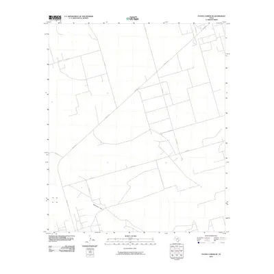
2010 Map of Paynes Corner SE
USGS Topo · Published 2010About this map
Monument Draw snakes through this high plains landscape of Gaines County, forming the primary natural relief in an area otherwise defined by a meticulous grid of agricultural and ranch roads. The terrain is a clear example of modern Texas land use, where the diagonal path of Ranch Rd 181 cuts across the cardinal geometry of the local survey system. Throughout this quadrangle, smaller arteries like Co Rd 320 and Co Rd 330 provide access to the flat, expansive parcels characteristic of the Llano Estacado. This 2010 survey records the infrastructure of the Permian Basin region, illustrating the interface between the ephemeral watercourse of the draw and the man-made network of county roads that facilitate the local ranching economy.
Find a feature on this map
9 named features on this map. Tap any name to fly to it.
Don’t see what you’re looking for? This feature index may not catch every label — zoom into the map to look around manually.
Map Details
Editions of this 2010 Paynes Corner SE Map
This is the sole edition of this map. No revisions or reprints were ever made.
Other maps of this area

1954 · Hobbs
USGS Topo · 1:250,000

1958 · Hobbs
USGS Topo · 1:250,000

1969 · Seminole SW
USGS Topo · 1:24,000

1970 · Seminole
USGS Topo · 1:24,000

1971 · Paynes Corner
USGS Topo · 1:24,000

1971 · Brinson Ranch
USGS Topo · 1:24,000

1971 · Paynes Corner SE
USGS Topo · 1:24,000

1971 · Frankel City
USGS Topo · 1:24,000

1971 · Jumbo Hill
USGS Topo · 1:24,000
1971 · Paynes Corner NW
USGS Topo · 1:24,000