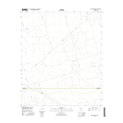
2016 Map of Paynes Corner SE
USGS Topo · Published 2016About this map
Monument Draw cuts across the southern portion of this landscape, providing a rare hydrological feature in an area defined by its systematic grid of rural transit. Situated along the boundary where Gaines County meets Andrews County, the terrain is sparsely populated and dominated by long, straight stretches of road. Key thoroughfares such as Ranch Rd 181 and N Fm 181 serve as the primary connectors for ranching operations and oil field access in this corner of the Permian Basin. The map details a dense network of county roads, including Co Rd 330 and Co Rd 319, which delineate the expansive, flat parcels characteristic of West Texas. This 2016 survey reflects the modern agricultural and industrial infrastructure of the region, showing the exact placement of local tracks and drainage patterns like those near Co Rd 327.
Find a feature on this map
12 named features on this map. Tap any name to fly to it.
Don’t see what you’re looking for? This feature index may not catch every label — zoom into the map to look around manually.
Map Details
Editions of this 2016 Paynes Corner SE Map
This is the sole edition of this map. No revisions or reprints were ever made.
Other maps of this area

1954 · Hobbs
USGS Topo · 1:250,000

1958 · Hobbs
USGS Topo · 1:250,000

1969 · Seminole SW
USGS Topo · 1:24,000

1970 · Seminole
USGS Topo · 1:24,000

1971 · Paynes Corner
USGS Topo · 1:24,000

1971 · Brinson Ranch
USGS Topo · 1:24,000

1971 · Paynes Corner SE
USGS Topo · 1:24,000

1971 · Frankel City
USGS Topo · 1:24,000

1971 · Jumbo Hill
USGS Topo · 1:24,000
1971 · Paynes Corner NW
USGS Topo · 1:24,000