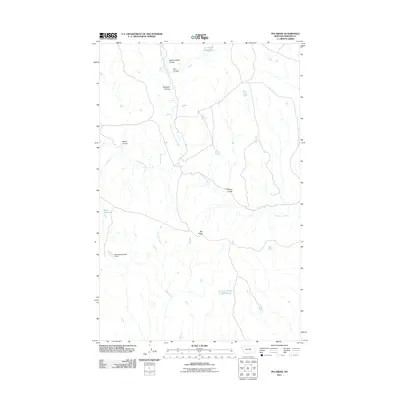
2011 Map of Pea Ridge
USGS Topo · Published 2011About this map
Pea Ridge serves as the central topographic focal point of this Phillips County landscape, characterized by an intricate network of seasonal drainages and water management features. The local geography is defined by numerous coulees, such as Horse Pasture Coulee and Clayton Coulee, which channel runoff into the North Fork Fourchette Creek system. This 2011 survey illustrates the importance of water storage in this arid region of Montana, documenting several man-made catchments including Siwash Reservoir, Shale Reservoir, and the Pea Ridge Number 1 Dam. The naming conventions found on the map, such as Fish Fossil Reservoir and Hardpan Coulee, provide insight into the geological and paleontological interests of the area. Ranching and land management are evident through the network of local roads that navigate around Hawley Creek and the various ridges that define the watershed boundaries of the Fourchette Creek drainage basin.
Find a feature on this map
13 named features on this map. Tap any name to fly to it.
Don’t see what you’re looking for? This feature index may not catch every label — zoom into the map to look around manually.
Map Details
Editions of this 2011 Pea Ridge Map
This is the sole edition of this map. No revisions or reprints were ever made.
Other maps of this area

1954 · Jordan
USGS Topo · 1:250,000

1954 · Lewistown
USGS Topo · 1:250,000

1956 · Jordan
USGS Topo · 1:250,000

1958 · Jordan
USGS Topo · 1:250,000

1959 · Lewistown
USGS Topo · 1:250,000

1964 · Jordan
USGS Topo · 1:250,000

1965 · Karsten Coulee
USGS Topo · 1:24,000

1965 · Chain Buttes
USGS Topo · 1:24,000

1965 · Locke Ranch
USGS Topo · 1:24,000
1965 · Mickey Butte
USGS Topo · 1:24,000