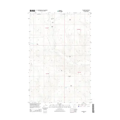
2014 Map of Pea Ridge
USGS Topo · Published 2014About this map
Pea Ridge rises as the central topographic prominence in this high plains landscape of Phillips County, where a network of seasonal watercourses has carved a complex series of breaks. The drainage system is defined by Fourchette Cr and its various tributaries, including the N Fork Fourchette Cr and S Fork Fourchette Cr. These coulees, such as Horse Pasture Coulee and Clayton Coulee, reflect a long history of rangeland use, where naming conventions often identified specific grazing or management areas. Human intervention in this arid environment is most visible through a series of catchment basins, notably Siwash Reservoir, Shale Reservoir, and the intriguing Fish Fossil Reservoir. This 2014 survey by the U.S. Geological Survey documents the traditional land divisions of the Public Land Survey System, including t23n r29e and t23n r30e, illustrating how the grid of section lines overlays the irregular natural drainages of the Missouri River breaks region.
Find a feature on this map
19 named features on this map. Tap any name to fly to it.
Don’t see what you’re looking for? This feature index may not catch every label — zoom into the map to look around manually.
Map Details
Editions of this 2014 Pea Ridge Map
This is the sole edition of this map. No revisions or reprints were ever made.
Other maps of this area

1954 · Jordan
USGS Topo · 1:250,000

1954 · Lewistown
USGS Topo · 1:250,000

1956 · Jordan
USGS Topo · 1:250,000

1958 · Jordan
USGS Topo · 1:250,000

1959 · Lewistown
USGS Topo · 1:250,000

1964 · Jordan
USGS Topo · 1:250,000

1965 · Karsten Coulee
USGS Topo · 1:24,000

1965 · Chain Buttes
USGS Topo · 1:24,000

1965 · Locke Ranch
USGS Topo · 1:24,000
1965 · Mickey Butte
USGS Topo · 1:24,000