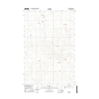
2017 Map of Pea Ridge
USGS Topo · Published 2017About this map
Pea Ridge and the winding drainages of Phillips County define this 2017 survey, where a complex network of coulees and intermittent water sources sustains the high plains. The landscape is carved by deep erosion features including Horse Pasture Coulee, Hardpan Coulee, and Cottonwood Coulee, all of which feed toward the N Fork Fourchette Cr and the main branch of Fourchette Cr. Scattered water management features like Shale Reservoir and the Fish/Fossil Reservoir provide critical infrastructure for this part of Montana. Isolated transportation is represented by Midale Road, while the Public Land Survey System grid provides the primary framework for the area, which spans four townships including t23n r29e and t22n r30e. This map illustrates the intersection of geological history and modern land use in a region where every named coulee and reservoir represents a vital resource.
Find a feature on this map
19 named features on this map. Tap any name to fly to it.
Don’t see what you’re looking for? This feature index may not catch every label — zoom into the map to look around manually.
Map Details
Editions of this 2017 Pea Ridge Map
This is the sole edition of this map. No revisions or reprints were ever made.
Other maps of this area

1954 · Jordan
USGS Topo · 1:250,000

1954 · Lewistown
USGS Topo · 1:250,000

1956 · Jordan
USGS Topo · 1:250,000

1958 · Jordan
USGS Topo · 1:250,000

1959 · Lewistown
USGS Topo · 1:250,000

1964 · Jordan
USGS Topo · 1:250,000

1965 · Karsten Coulee
USGS Topo · 1:24,000

1965 · Chain Buttes
USGS Topo · 1:24,000

1965 · Locke Ranch
USGS Topo · 1:24,000
1965 · Mickey Butte
USGS Topo · 1:24,000