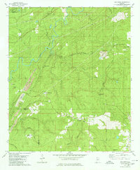
1979 Map of Pea Ridge
USGS Topo · Published 1980About this map
The Cahaba River winds through this 1970s landscape, serving as a geographic anchor for a region defined by industrial extraction and small community pockets. The map documents an intensive mining corridor along the western edge, where the Strip Mine and the community of Marvel reflect the area's coal heritage. These operations follow the geologic contours of the land, leaving distinctive markers like the Tailings Ponds near the Southern railroad line.
Find a feature on this map
52 named features on this map. Tap any name to fly to it.
Don’t see what you’re looking for? This feature index may not catch every label — zoom into the map to look around manually.
Map Details
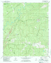
Editions of this 1979 Pea Ridge Map
2 editions found
Other maps of this area

1890 · Bessemer
USGS Topo · 1:125,000

1892 · Bessemer
USGS Topo · 1:125,000

1899 · Brookwood
USGS Topo · 1:125,000

1905 · Bessemer Iron District
USGS Topo · 1:62,500

1907 · Bessemer Special
USGS Topo · 1:62,500

1910 · Montevallo
USGS Topo · 1:62,500

1927 · Adger
USGS Topo · 1:48,000

1932 · Yolande
USGS Topo · 1:62,500

1934 · Blocton
USGS Topo · 1:48,000

1935 · Yolande
USGS Topo · 1:62,500