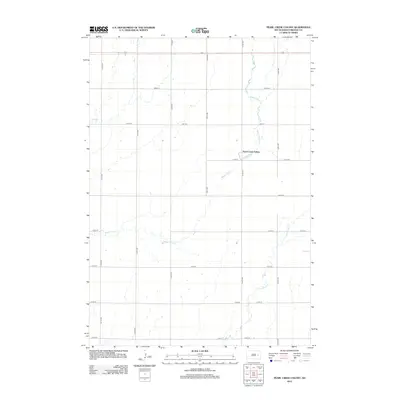
2012 Map of Pearl Creek Colony
USGS Topo · Published 2012About this map
Pearl Creek Colony sits at the heart of this Beadle County landscape, an area defined by the branching hydrography of the James River basin in the early 21st century. The terrain is delineated by a strict section-line road grid, where North-South routes like 413th Ave and 415th Ave intersect with East-West roads including 211th St. These straight-line corridors contrast with the meandering paths of Pearl Creek and the Middle Pearl Creek, which carve natural deviations through the agricultural blocks. The drainage pattern is further detailed by the S Fork Pearl Creek in the southeastern quadrant. This survey illustrates the persistent Jeffersonian grid system typical of the Great Plains, showing how contemporary infrastructure and rural settlements remain bound to the original land survey patterns established over a century prior.
Find a feature on this map
19 named features on this map. Tap any name to fly to it.
Don’t see what you’re looking for? This feature index may not catch every label — zoom into the map to look around manually.
Map Details
Editions of this 2012 Pearl Creek Colony Map
This is the sole edition of this map. No revisions or reprints were ever made.
Other maps of this area

1898 · Huron
USGS Topo · 1:125,000

1899 · De Smet
USGS Topo · 1:125,000

1953 · Huron
USGS Topo · 1:250,000

1953 · Watertown
USGS Topo · 1:250,000

1954 · Huron
USGS Topo · 1:250,000

1957 · Forestburg NE
USGS Topo · 1:24,000

1957 · Cavour
USGS Topo · 1:24,000

1958 · Watertown
USGS Topo · 1:250,000
1958 · Huron NE
USGS Topo · 1:24,000

1971 · Iroquois
USGS Topo · 1:24,000