
1957 Map of Cavour
USGS Topo · Published 1958About this map
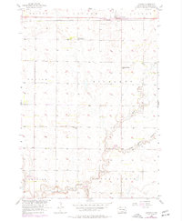
Cavour sits as the primary rail settlement along the Chicago and North Western line in the late 1950s, serving as a hub for the surrounding agricultural townships. The landscape is defined by a dense network of rural schoolhouses, illustrating the decentralized educational system of mid-century Beadle County. Local landmarks like the Richland Sch (Abandoned), Gable Sch, and Bloodgood Sch are positioned at regular intervals across the grid, while the Richland Center Sch serves the central district.
Find a feature on this map
23 named features on this map. Tap any name to fly to it.
Don’t see what you’re looking for? This feature index may not catch every label — zoom into the map to look around manually.
Map Details
Editions of this 1957 Cavour Map
2 editions found
Other maps of this area

1898 · Huron
USGS Topo · 1:125,000

1899 · De Smet
USGS Topo · 1:125,000

1953 · Huron
USGS Topo · 1:250,000

1953 · Watertown
USGS Topo · 1:250,000

1954 · Huron
USGS Topo · 1:250,000

1957 · Forestburg NE
USGS Topo · 1:24,000

1957 · Huron
USGS Topo · 1:24,000

1958 · Watertown
USGS Topo · 1:250,000

1958 · Forestburg NW
USGS Topo · 1:24,000

1958 · Huron NW
USGS Topo · 1:24,000