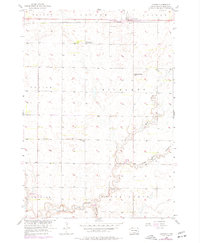
1957 Map of Cavour
USGS Topo · Published 1977About this map
Cavour sits at the northern edge of this Beadle County landscape, serving as a focal point for the surrounding prairie townships. The Chicago and North Western railroad bisects the town, providing a critical transport artery for the agricultural region. South of the settlement, the map reveals a decentralized educational network reflected by the Richland Center Sch and Bloodgood Sch, while the notation of Richland Sch (Abandoned) suggests early shifts in local rural populations. The terrain is defined by the winding paths of Pearl Creek and Middle Pearl Creek, which flow through the townships of Richland and Pearl Creek. This mid-century survey, updated with 1970s revisions, illustrates a transition in land use, from traditional homesteading patterns toward modern infrastructure like the Landing Field near the southern border in Clifton.
Find a feature on this map
19 named features on this map. Tap any name to fly to it.
Don’t see what you’re looking for? This feature index may not catch every label — zoom into the map to look around manually.
Map Details
Editions of this 1957 Cavour Map
2 editions found
Other maps of this area

1898 · Huron
USGS Topo · 1:125,000

1899 · De Smet
USGS Topo · 1:125,000

1953 · Huron
USGS Topo · 1:250,000

1953 · Watertown
USGS Topo · 1:250,000

1954 · Huron
USGS Topo · 1:250,000

1957 · Forestburg NE
USGS Topo · 1:24,000

1957 · Cavour
USGS Topo · 1:24,000

1957 · Huron
USGS Topo · 1:24,000

1958 · Watertown
USGS Topo · 1:250,000

1958 · Forestburg NW
USGS Topo · 1:24,000