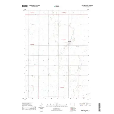
2017 Map of Pearl Creek Colony
USGS Topo · Published 2017About this map
Pearl Creek Colony serves as a focal point of human settlement in this section of Beadle County, positioned along the meandering path of Middle Pearl Cr. The landscape is defined by the repetitive, orderly grid of the Public Land Survey System, which dictates the placement of rural roads such as Co RD 33 and 414TH Ave. These corridors facilitate movement through a region dominated by the drainage patterns of the Pearl Cr system, including the S Fork Pearl Cr. This modern survey illustrates how agricultural land divisions, etched into townships like t110n r59w, remain the primary structural influence on the South Dakota prairie. The map provides a clear view of the relationship between these small watercourses and the section-line roads that navigate around the local wetlands and intermittent streams.
Find a feature on this map
25 named features on this map. Tap any name to fly to it.
Don’t see what you’re looking for? This feature index may not catch every label — zoom into the map to look around manually.
Map Details
Editions of this 2017 Pearl Creek Colony Map
This is the sole edition of this map. No revisions or reprints were ever made.
Other maps of this area

1898 · Huron
USGS Topo · 1:125,000

1899 · De Smet
USGS Topo · 1:125,000

1953 · Huron
USGS Topo · 1:250,000

1953 · Watertown
USGS Topo · 1:250,000

1954 · Huron
USGS Topo · 1:250,000

1957 · Forestburg NE
USGS Topo · 1:24,000

1957 · Cavour
USGS Topo · 1:24,000

1958 · Watertown
USGS Topo · 1:250,000
1958 · Huron NE
USGS Topo · 1:24,000

1971 · Iroquois
USGS Topo · 1:24,000