2021 Map of Pearl Creek Colony
USGS Topo · Published 2021About this map
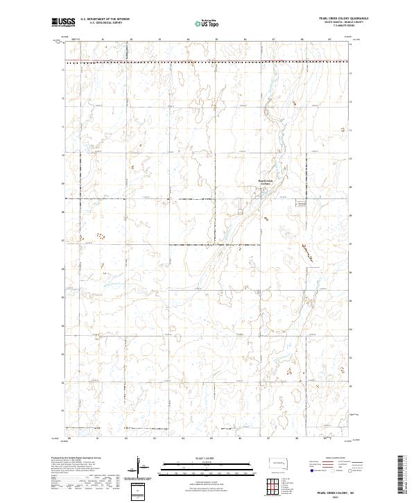
Pearl Creek Colony serves as a central landmark in this portion of Beadle County, positioned along the banks of Middle Pearl Cr. The landscape is characterized by a precise grid of agricultural roads, including Co Rd 35 and 415th Ave, which divide the terrain into township and range sections such as t110n r59w and t111n r59w. The hydrology of the region is defined by the branching network of Pearl Creek, with the S Fork Pearl Cr and Pearl Cr proper weaving through the prairie. This 2021 survey illustrates a modern rural layout where transportation follows strict sectional lines, reflecting the long-standing Public Land Survey System. The map provides a detailed view of the drainage patterns and local infrastructure necessary for the communal agricultural life of the colony.
Find a feature on this map
28 named features on this map. Tap any name to fly to it.
Don’t see what you’re looking for? This feature index may not catch every label — zoom into the map to look around manually.
Map Details
Editions of this 2021 Pearl Creek Colony Map
This is the sole edition of this map. No revisions or reprints were ever made.