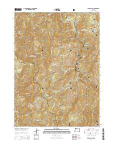
2014 Map of Pearsoll Peak
USGS Topo · Published 2014About this map
Siskiyou National Forest dominates this landscape along the boundary of Josephine and Curry Counties. The high-elevation terrain is defined by the prominent Pearsoll Peak, where the drainage divide separates the waters of the Illinois River to the east from the headwaters of the Chetco River to the west. This 2014 survey reveals a network of remote naming conventions, including local landmarks like Gold Basin Butte, Eagle Mtn, and Nome Peak. Steep canyons are etched by numerous tributaries such as Five Finger Gulch and Lightning Creek. A few isolated level spots like Sourdough Flat and School Flat interrupt the verticality of the peaks. The river corridors provide the primary corridors for navigation and geography, with features like Miami Bar along the Illinois River and the crossing at Chetco Pass serving as key reference points in this wilderness environment.
Find a feature on this map
55 named features on this map. Tap any name to fly to it.
Don’t see what you’re looking for? This feature index may not catch every label — zoom into the map to look around manually.
Map Details
Editions of this 2014 Pearsoll Peak Map
This is the sole edition of this map. No revisions or reprints were ever made.
Other maps of this area

1917 · Kerby
USGS Topo · 1:125,000

1918 · Kerby
USGS Topo · 1:125,000

1945 · Kerby
USGS Topo · 1:125,000

1954 · Cave Junction
USGS Topo · 1:62,500

1954 · Selma
USGS Topo · 1:62,500

1954 · Chetco Peak
USGS Topo · 1:62,500

1954 · Pearsoll Peak
USGS Topo · 1:62,500

1955 · Medford
USGS Topo · 1:250,000

1957 · Medford
USGS Topo · 1:250,000

1958 · Medford
USGS Topo · 1:250,000