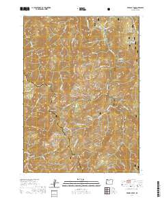
2020 Map of Pearsoll Peak
USGS Topo · Published 2020About this map
Siskiyou National Forest encompasses this wilderness area where the Kalmiopsis Rim divides the drainage basins of two major protected waterways. In the north, the Illinois Wild and Scenic River winds through deep canyons, joined by tributaries such as Oak Flat Cr and Baker Cr near the riverfront landing at Miami Bar. The terrain is defined by high elevations, including Pearsoll Peak and Gold Basin Butte, which overlook the transition into the southern watershed. In the southwest corner, the Chetco Wild and Scenic River begins its course, fed by the Upper Chetco and Slide Cr. Historical travel through this complex landscape is evidenced by the positioning of Chetco Pass and various named flats, such as Sourdough Flat and Horse Flat, which provided rare level ground amidst the steep ridges and gulches.
Find a feature on this map
54 named features on this map. Tap any name to fly to it.
Don’t see what you’re looking for? This feature index may not catch every label — zoom into the map to look around manually.
Map Details
Editions of this 2020 Pearsoll Peak Map
This is the sole edition of this map. No revisions or reprints were ever made.
Other maps of this area

1917 · Kerby
USGS Topo · 1:125,000

1918 · Kerby
USGS Topo · 1:125,000

1945 · Kerby
USGS Topo · 1:125,000

1954 · Cave Junction
USGS Topo · 1:62,500

1954 · Selma
USGS Topo · 1:62,500

1954 · Chetco Peak
USGS Topo · 1:62,500

1954 · Pearsoll Peak
USGS Topo · 1:62,500

1955 · Medford
USGS Topo · 1:250,000

1957 · Medford
USGS Topo · 1:250,000

1958 · Medford
USGS Topo · 1:250,000